
The biggest map and engraving supply in Hungary.

Sós Antikvárium
Designed and made bysimilar topics:
postcard, photo/United Kingdom
te144. map/United Kingdom put into the basket Homann Heredibus: Regionis qvae est circa Londinum (London) specialis repraesentatio geographica.1741. colored copper engraving.size: 50x56 cm. page: 55x65 cm. intact margin. price: 255.68 EUROAt the bottom, there is a very fine London Westminster city view. | 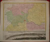 |
te250. map/United Kingdom put into the basket Homann, Johann Baptist: Magnae Britanniae Pars Meridionale, in qua Regnum Angliae.Nürnberg. ca. 1720. hand colored copper engraving.size: 56x48 cm. page: 61x53 cm. intact margin. price: 255.68 EUROIn the English Channel is an engraved vignette of Queen Anne in the House of Lords. | 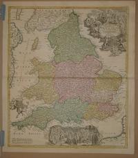 |
te438. map/United Kingdom put into the basket BRIT SZIGETEK.Budapest. ca. 1930. .size: 79x56 cm. page: 88x62 cm. intact margin. price: 4.26 EURO | 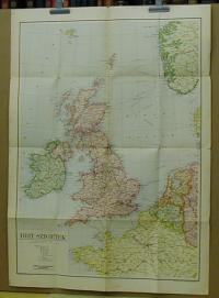 |
te516. map/United Kingdom put into the basket Homann Heredibus: Regnum Magnae Britanniae et Hiberniae Mappa Georgraphica.Nürnberg. 1749. hand colored copper engraving.size: 45x52 cm. page: 51x58 cm. minimaly stained outside the picture. minimal implosion on the margin. price: 170.45 EURO | 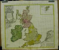 |
te959. map/United Kingdom put into the basket Robert De Vaugondy: Carte des grandes routes d'Angleterre, d'Ecosse, et d'Irlande. Par le Sr. Robert.Paris. 1757. border colored copper engraving.size: 45x56 cm. page: 54x82 cm. clean, sharp issue. intact margin. price: 198.86 EURO | 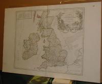 |
te1295. map/United Kingdom put into the basket Thorton William: Plan of Cheap Ward. Plan of Tower Street Ward.London. 1784. copper engraving.size: 31x19 cm. page: 39x25 cm. price: 17.05 EUROLondon. | 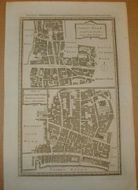 |
te1296. map/United Kingdom put into the basket Thorton William: Plan of Baynards Castle Ward. Plan of Canlewick and Langborn Wards.London. 1784. copper engraving.size: 30x18 cm. page: 39x25 cm. price: 17.05 EURO | 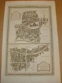 |
te1297. map/United Kingdom put into the basket Thorton William: Plan of Bishopsgate Ward. Plan of Alderagate Ward. Plan of Bread Street & Cordwaners Wards.London. 1784. copper engraving.size: 30x18 cm. page: 39x25 cm. price: 17.05 EURO | 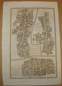 |
te1298. map/United Kingdom put into the basket Thorton William: Plan of Billingsgate Ward. Plan of Faringdon Ward.London. 1784. copper engraving.size: 30x18 cm. page: 39x25 cm. price: 17.05 EURO | 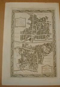 |
te1299. map/United Kingdom put into the basket Thorton William: Plan of Colemann Street. Plan of Portsoken Ward. Plan of Cripplegate Ward.London. 1784. copper engraving.size: 30x18 cm. page: 39x25 cm. price: 17.05 EURO | 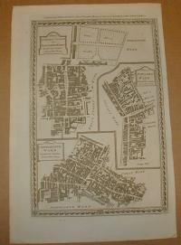 |
te1456. map/United Kingdom put into the basket Seutter, Matthaus: Tabula Novissima Accuratissima Regnorum Angliae, Scotiae, Hiberniae.Augsburg. ca.1725. hand colored copper engraving.size: 57x48 cm. page: 62x54 cm. price: 340.91 EURO | 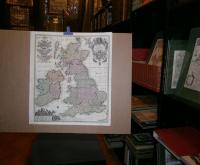 |
te1539. map/United Kingdom put into the basket Mollo, Tranquillo (kiadó): General Carte von Gross Brittannien.Wien. 1817. border colored copper engraving.size: 44x32 cm. page: 48x37 cm. stained outside the picture. price: 113.64 EUROMegjelent: Lehrbuch der Geographie, zeigt das Kaisertum Österreich nach dem Wiener Kongress. | 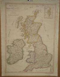 |
